A Quiet Comparison
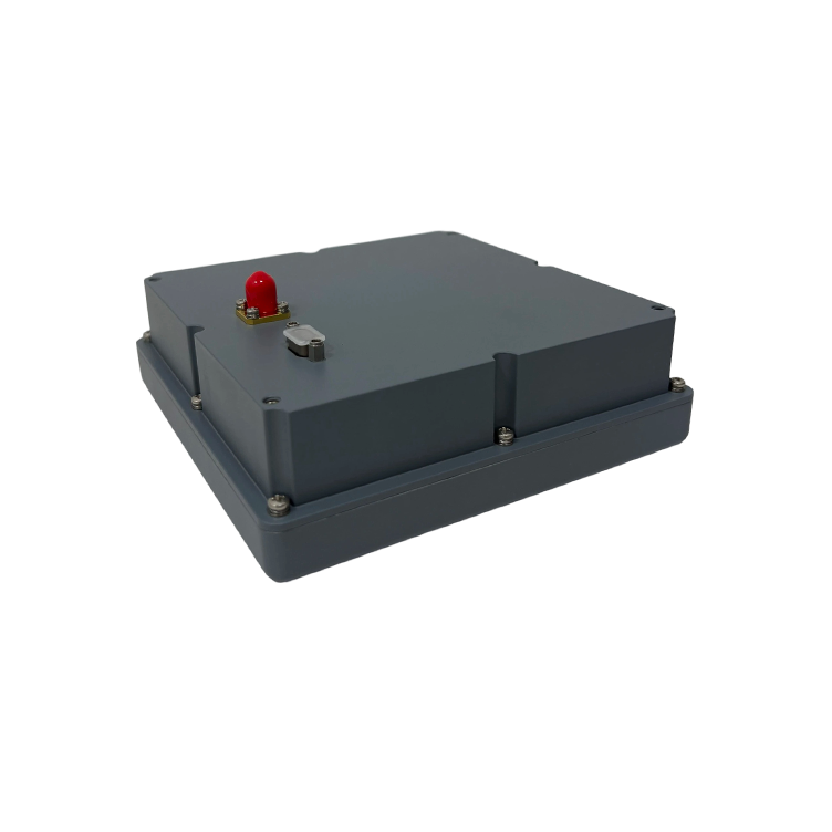
Two systems walk a tightrope: one reads the world in pixels and angles, the other listens to satellites. Against that duet I set the compass—measuring how visual navigation balancing stacks up against signal resilience when path tracking must be exact. Early on, designers pair camera-based pose estimation with GNSS for long-range reference; where satellite signals wobble, an anti-jamming GNSS antenna acts like a calm hand on the helm. The comparison is not an argument but a scorecard: stability, latency, and error modes shape the verdict.
Why Balance Matters
Visual navigation supplies rich, local geometry—lane markings, feature tracks, horizon lines—while satellite fixes give global context. When fusion tilts too far toward vision, systems suffer drift and multipath becomes a quiet thief. Lean too heavily on GNSS and a jammer or spoofing event erases the plot. The art is weighting: sensor fusion that respects short-term visual certainty and long-term GNSS anchoring produces steadier path tracking and fewer corrective jerks.
Head-to-Head: Algorithms and Antennas
Compare two approaches in practical terms. Approach A emphasizes advanced visual odometry with loop closure; it excels where landmarks repeat and lighting holds. Approach B prioritizes robust RF front-ends—beamforming and jamming mitigation built into the antenna—and falls back on precise satellite fixes when features vanish. Both require calibration, both tolerate error differently. The choice often comes down to environment: urban canyons punish GNSS, open highways punish vision; ports and airports have historically seen concentrated GNSS interference reported to civil authorities, which makes the anti jam antenna strategy practical for many fleets.
Practical Trade-offs and Common Mistakes
Teams commonly commit two sins: they tune fusion for a single condition, and they treat hardware as immutable. Fixing one without the other is like composing music with one instrument. Overfitting a filter to sunny, static scenes gives brittle tracking in rain; under-investing in antenna nulling leaves you at the mercy of deliberate jammers. Alternatives exist—high-rate inertial units, additional LiDAR layers—but each adds cost and complexity. A prudent stack mixes visual smoothing, occasional LiDAR checkpoints, and RF resilience; close attention to latency and failure modes saves long-term rework.
Design Patterns That Outperform
Some patterns repeat across successful projects. Use hierarchical fusion: fast visual loops correct local pose, slower GNSS updates correct drift. Employ adaptive weighting that recognizes confidence—when visual feature count drops, raise the antenna’s influence. Include a watchdog that flags sustained inconsistency between sensors; log these episodes for offline diagnosis. Hardware matters: a compact anti jam antenna can prevent whole classes of failure, and software must expose graceful degradation instead of brittle handoffs.
Advisory: Three Golden Rules for Choosing the Right Mix
1) Measure real-world exposure first—know where your platform will operate and use field reports of GNSS interference near airports and shipping lanes as a baseline for required jamming mitigation. 2) Insist on adaptive fusion that alters weights based on instantaneous sensor confidence; low feature counts or high multipath should trigger higher reliance on RF or inertial cues. 3) Validate end-to-end latency and loop stability: track RMS error over representative routes and confirm the system remains bounded under deliberate signal degradation. Pair these metrics with regular hardware checks—antenna health, beamforming accuracy—and you keep surprises small. This approach naturally favors suppliers who design both the processing stack and the antenna hardware, a role Archimedes Innovation plays with integrated solutions that bridge visual navigation and resilient GNSS. Quiet exactness.